
Stay Informed
Sign up to receive industry trends, news, and updates from EBA.

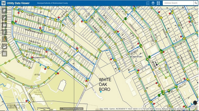
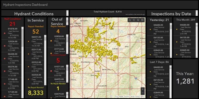
geographIT, a division of EBA Engineering, Inc., completed an Enterprise GIS Needs Assessment and Implementation Plan for the Municipal Authority of Westmoreland County (MAWC) in Pennsylvania. The needs assessment report summarizes each department’s GIS mapping activities, current practices and capabilities, and future data and application requirements. The implementation plan identifies implementation activities, a phased budget, and a 5-year schedule.
Implementation activities included upgrading MAWC’s current GIS to an enterprise-wide system consisting of centralized servers and distributed desktop, web, and mobile clients operating on state-of-the-art technology platforms. geographIT also developed new database schemas, migrated and reconciled existing asset datasets to a new centralized enterprise GIS database, developed new datasets to support departmental operations, developed new workflows with customized productivity applications, integrated external systems and document libraries, and trained MAWC staff.
More than a year since project initiation, MAWC has over 100 named users of the ArcGIS Portal web GIS viewers and mobile apps in support of a variety of customer service, operations, and maintenance activities. The system is continuously expanding with new published services, web apps, and mobile apps that serve many different departments. GIS has become such an essential resource to operations that a system architecture design has been delivered to implement a redundant 24×7 failover site to ensure uninterrupted service.
Explore how geographIT is helping the Municipal Authority of Westmoreland County achieve their enterprise GIS vision: click here
Sign up to receive industry trends, news, and updates from EBA.
At EBA, you can count on our commitment to helping you realize your full potential.